
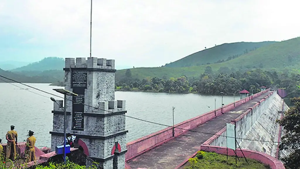
The water level in Mullaperiyar dam reached 137.55 feet on Tuesday, just below the maximum permissible level of 142 ft. Meanwhile, the Vaigai dam recorded a water level of 71 ft, which is at its maximum capacity. The combined storage in Periyar credit stands at 9,138 mcft.
Water Flow Rates
The inflow and discharge rates for both dams are as follows: Mullaperiyar dam had an inflow of 980 cusecs and a discharge of 105 cusecs, while Vaigai dam recorded an inflow and discharge rate of 1,928 cusecs.
Rainfall Data
The rainfall in the region over the last 24 hours ending at 6 a.m. on Tuesday showed varied amounts in different areas. Shanmuganadhi dam recorded 10.4 mm of rainfall, followed by Kodaikanal with 6.4 mm, and Thekkadi with 5.6 mm. The rainfall in several other areas ranged from 4.2 mm to 0.6 mm.
Impact on Water Resources
It’s essential to monitor these water levels and rainfall data as they directly impact the availability of water resources in the region. The existing levels and flow rates will significantly affect agricultural and domestic water supply, especially during the dry months.
Efforts for Water Conservation
Given the critical importance of these water sources, initiatives for water conservation and efficient use of water resources are increasingly crucial. Government agencies and local communities need to work together to ensure sustainable water management practices.
Conclusion
As we continue to track these water levels and rainfall patterns, it’s evident that they play a vital role in the overall well-being of the region. With proactive measures and effective management, we can strive to maintain the equilibrium of water resources and mitigate the impact of any potential water scarcity.